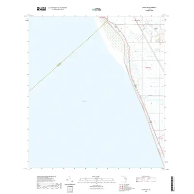
2021 Map of Chancy Bay
USGS Topo · Published 2021About this map
Lake Okeechobee dominates the western half of this landscape, its vast surface meeting the eastern shoreline along a structured levee system. This 2021 survey reveals a transitional area where the open waters of the lake give way to the wetlands and managed lands of Chancy Bay. Along the eastern rim, a corridor of transportation and recreation follows the shoreline, featuring the Florida National Scenic Trl and the Florida East Coast rail line. The interior terrain is defined by a grid of canals and drainage ditches typical of south Florida's reclaimed agricultural and ranching lands. Grounded features like the Brady Ranch Airport and local developments such as Chukker Cir indicate the modern footprint of land use in this part of Martin County, situated just across the county line from Okeechobee County.
Find a feature on this map
11 named features on this map. Tap any name to fly to it.
Don’t see what you’re looking for? This feature index may not catch every label — zoom into the map to look around manually.
Map Details
Editions of this 2021 Chancy Bay Map
This is the sole edition of this map. No revisions or reprints were ever made.
Other maps of this area

1952 · Okeechobee
USGS Topo · 1:24,000

1953 · Okeechobee 4 SW
USGS Topo · 1:24,000

1953 · Okeechobee 4 SE
USGS Topo · 1:24,000

1953 · Okeechobee 4 NE
USGS Topo · 1:24,000

1953 · Okeechobee 4 NW
USGS Topo · 1:24,000

1956 · West Palm Beach
USGS Topo · 1:250,000

1956 · Fort Pierce
USGS Topo · 1:250,000

1957 · West Palm Beach
USGS Topo · 1:250,000

1958 · Fort Pierce
USGS Topo · 1:250,000

1958 · West Palm Beach
USGS Topo · 1:250,000