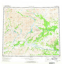
1956 Map of Chandalar
USGS Topo · Published 1967About this map
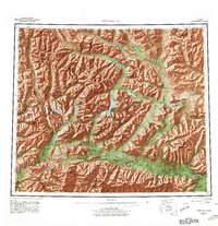
Chandalar Mine and numerous other Gold Mines are central to this mid-century survey, illustrating the remote extractive industry of the Brooks Range region. The landscape is dominated by the complex drainage systems of the North Fork Chandalar River, Middle Fork Chandalar River, and East Fork Chandalar River. Small settlements such as Chandalar, Caro, and Venetie appear along these water routes, often connected only by a Winter Trail or a specific Landing Area. The map also delineates the eastern portion of the Indian Reservation near the Chuttoh Bluffs, providing a record of land use and indigenous territory during this period of territorial administration. High peaks like Sukakpak Mountain and Snowden Mountain frame the river valleys, marking a terrain where navigation depended heavily on mountain passes like Tobin Pass and Linda Creek Pass.
Find a feature on this map
91 named features on this map. Tap any name to fly to it.
Don’t see what you’re looking for? This feature index may not catch every label — zoom into the map to look around manually.
Map Details
Editions of this 1956 Chandalar Map
8 editions found

Other maps of this area

1951 · Fort Yukon
USGS Topo · 1:250,000

1951 · Bettles
USGS Topo · 1:250,000

1951 · Chandler Lake
USGS Topo · 1:250,000

1951 · Chandalar
USGS Topo · 1:250,000

1951 · Christian
USGS Topo · 1:250,000

1951 · Brooks
USGS Topo · 1:250,000

1951 · Beaver
USGS Topo · 1:250,000

1951 · Arctic
USGS Topo · 1:250,000

1951 · Wiseman
USGS Topo · 1:250,000

1956 · Arctic
USGS Topo · 1:250,000