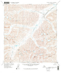
1971 Map of Chandler Lake A-1
USGS Topo · Published 1973About this map
The Continental Divide cuts across this high-altitude landscape of the Brooks Range, separating the northward-flowing Itkillik River from the headwaters of the North Fork Koyukuk River which trends toward the south. The terrain is dominated by the massive Oolah Valley and Itkillik Valley, where the drainage patterns illustrate the region's complex glacial and geological history. Evidence of human presence in this remote Arctic wilderness is sparse, marked only by a single Cabin near a small lake. Prominent peaks including Oolah Mountain, Snowwheel Mountain, and Oxadak Mountain flank the deep valleys. The map also records the South Boundary Umiat Meridian, providing a critical reference point for early 1970s land management and surveying in the North Slope region.
Find a feature on this map
15 named features on this map. Tap any name to fly to it.
Don’t see what you’re looking for? This feature index may not catch every label — zoom into the map to look around manually.
Map Details
Editions of this 1971 Chandler Lake A-1 Map
2 editions found
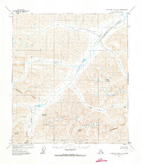
Other maps of this area

1951 · Chandler Lake
USGS Topo · 1:250,000

1951 · Chandalar
USGS Topo · 1:250,000

1951 · Brooks
USGS Topo · 1:250,000

1951 · Wiseman
USGS Topo · 1:250,000

1956 · Chandalar
USGS Topo · 1:250,000

1956 · Wiseman
USGS Topo · 1:250,000

1956 · Philip Smith Mountains
USGS Topo · 1:250,000

1956 · Chandler Lake
USGS Topo · 1:250,000

1964 · Wiseman
USGS Topo · 1:250,000

1964 · Chandalar
USGS Topo · 1:250,000