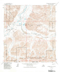
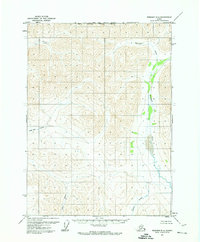
1971 Map of Chandler Lake A-3
USGS Topo · Published 1984About this map
Anaktuvuk Pass serves as the central focal point of this high-latitude survey, marking a critical breach in the Continental Divide where the Anaktuvuk River begins its northern descent. The landscape is defined by the logistics of Arctic survival and travel, evidenced by the Winter Road and a Landing Strip near the local settlements. Cultural markers are concentrated at Anaktuvuk North Base and Anaktuvuk South Base, which sit near Eleanor Lake and a small Cem. The surrounding territory, largely protected within Gates of the Arctic National Park, features prominent peaks like Mount Stuver and Napaktualuit Mountain. The drainage patterns of Anivik Creek and Akvatutak Creek illustrate the complex hydrology of the North Slope's mountain valleys during the early 1970s.
Find a feature on this map
29 named features on this map. Tap any name to fly to it.
Don’t see what you’re looking for? This feature index may not catch every label — zoom into the map to look around manually.
Map Details
Editions of this 1971 Chandler Lake A-3 Map
3 editions found
Other maps of this area

1951 · Chandler Lake
USGS Topo · 1:250,000

1951 · Wiseman
USGS Topo · 1:250,000

1956 · Wiseman
USGS Topo · 1:250,000

1956 · Chandler Lake
USGS Topo · 1:250,000

1964 · Wiseman
USGS Topo · 1:250,000

1964 · Chandler Lake
USGS Topo · 1:250,000
1971 · Chandler Lake A-2
USGS Topo · 1:63,360

1971 · Chandler Lake A-3
USGS Topo · 1:63,360
1971 · Chandler Lake B-2
USGS Topo · 1:63,360
1971 · Wiseman D-4
USGS Topo · 1:63,360