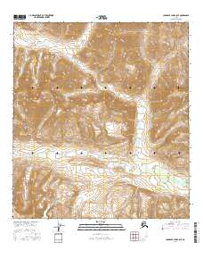
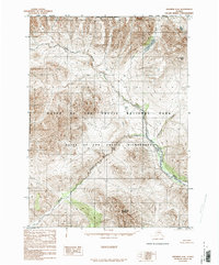
2016 Map of Chandler Lake A-5 SE
USGS Topo · Published 2016About this map
Gates of the Arctic National Park encompasses nearly the entire landscape in this northern interior region of Alaska. The terrain is characterized by the broad drainage patterns of the Chandler River, which flows through the northern reaches of the quadrangle. Moving south, the topographic relief reveals the headwaters and winding course of Ekokpuk Creek, cutting through high mountain passes. This 2016 survey illustrates the preservation of a roadless wilderness, where the only markings on the land are the township and range lines of the Public Land Survey System, such as t16s r3w and t15s r2w. The absence of human infrastructure highlights the territory’s status as a remote protected environment within the Brooks Range.
Find a feature on this map
9 named features on this map. Tap any name to fly to it.
Don’t see what you’re looking for? This feature index may not catch every label — zoom into the map to look around manually.
Map Details
Editions of this 2016 Chandler Lake A-5 SE Map
This is the sole edition of this map. No revisions or reprints were ever made.
Other maps of this area

1951 · Chandler Lake
USGS Topo · 1:250,000

1951 · Wiseman
USGS Topo · 1:250,000

1956 · Wiseman
USGS Topo · 1:250,000

1956 · Chandler Lake
USGS Topo · 1:250,000

1964 · Wiseman
USGS Topo · 1:250,000

1964 · Chandler Lake
USGS Topo · 1:250,000
1971 · Wiseman D-5
USGS Topo · 1:63,360
1986 · Chandler Lake A-5
USGS Topo · 1:63,360
1986 · Chandler Lake A-4
USGS Topo · 1:63,360
1986 · Wiseman D-6
USGS Topo · 1:63,360