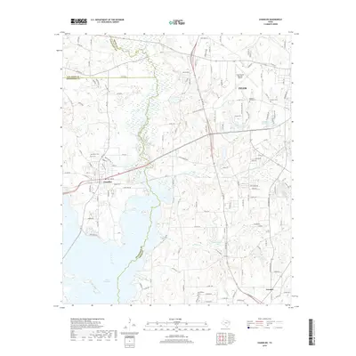
2019 Map of Chandler
USGS Topo · Published 2019About this map
The western edges of Tyler and the community of Chandler meet along the shores of Lake Palestine and the Neches River, where Smith, Henderson, and Van Zandt counties converge. This 2019 survey captures the developed infrastructure surrounding Tyler Pounds Regional Airport alongside significant local heritage sites like Macedonia Cem, Pleasant Retreat Cem, and Sevenleague Cem. The landscape is defined by its transition from urban development to a network of water bodies, including Peveto Lake, Lake Placid, and the waters of Indian Cr and Butler Cr. Residential expansions like Pleasant Retreat Acres sit between established landmarks and newer transit routes, while the settlement of Noonday marks the southeastern corner of the quadrangle. The map details a complex system of county roads and farm-to-market routes that facilitate movement through the varied East Texas terrain of creek basins and low ridges.
Find a feature on this map
130 named features on this map. Tap any name to fly to it.
Don’t see what you’re looking for? This feature index may not catch every label — zoom into the map to look around manually.
Map Details
Editions of this 2019 Chandler Map
This is the sole edition of this map. No revisions or reprints were ever made.
Other maps of this area

1946 · Bullard
USGS Topo · 1:62,500

1948 · Bullard
USGS Topo · 1:62,500

1948 · Tyler
USGS Topo · 1:62,500

1948 · Brownsboro
USGS Topo · 1:62,500

1949 · Tyler
USGS Topo · 1:62,500

1949 · Brownsboro
USGS Topo · 1:62,500

1949 · Frankston
USGS Topo · 1:62,500

1950 · Frankston
USGS Topo · 1:62,500

1956 · Tyler
USGS Topo · 1:250,000

1966 · Chandler
USGS Topo · 1:24,000