2022 Map of Chandler
USGS Topo · Published 2022About this map
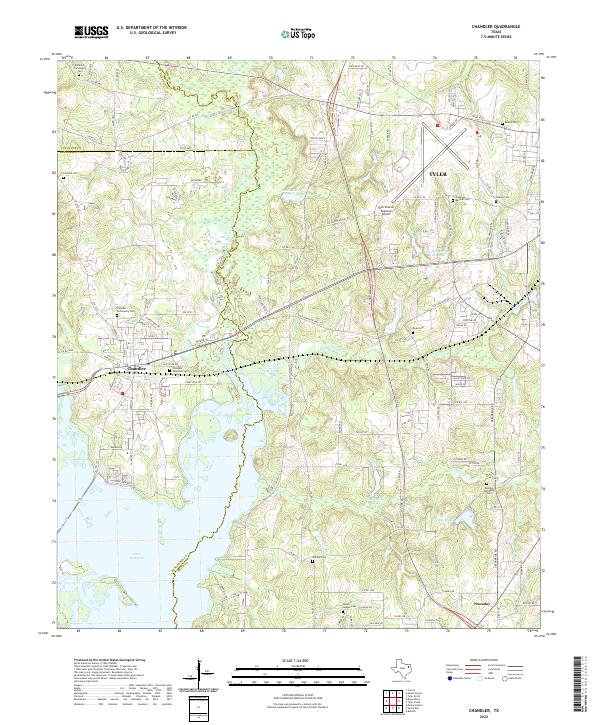
The Neches River forms the central spine of this landscape, winding through a complex network of wetlands and reservoirs at the junction of Henderson, Smith, and Van Zandt counties. This modern survey shows the expansion of Tyler toward its regional western borders, anchored by the significant footprint of the Tyler Pounds Regional Airport. To the southwest, the upper reaches of Lake Palestine dominate the terrain, reflecting the modern water management and recreational infrastructure that has reshaped the Neches valley.
Find a feature on this map
139 named features on this map. Tap any name to fly to it.
Don’t see what you’re looking for? This feature index may not catch every label — zoom into the map to look around manually.
Map Details
Editions of this 2022 Chandler Map
This is the sole edition of this map. No revisions or reprints were ever made.