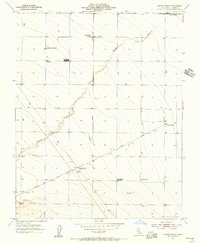
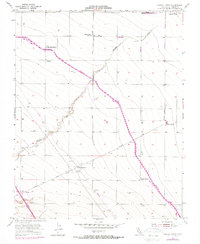
1955 Map of Chaney Ranch
USGS Topo · Published 1956About this map
Panoche Creek winds through the central landscape of this mid-1950s survey, illustrating the agricultural development of western Fresno County. The map reveals an economy built around large-scale ranching and cotton processing, marked by the presence of the Fairfax Gin and Chaney Gin. Numerous named family holdings like Murphy Ranch, La Jolla Ranch, and Gramis Ranch are connected by a grid of rural avenues including Belmont Avenue and Fairfax Avenue.
Find a feature on this map
22 named features on this map. Tap any name to fly to it.
Don’t see what you’re looking for? This feature index may not catch every label — zoom into the map to look around manually.
Map Details
Editions of this 1955 Chaney Ranch Map
5 editions found
Other maps of this area

1913 · Panoche
USGS Topo · 1:125,000

1921 · Tierra Loma School
USGS Topo · 1:31,680

1922 · Tufts Ranch
USGS Topo · 1:31,680

1922 · Chaney Ranch
USGS Topo · 1:31,680

1923 · Levis
USGS Topo · 1:31,680

1923 · Wisdom Well
USGS Topo · 1:31,680

1923 · Firebaugh
USGS Topo · 1:31,680

1923 · Tierra Loma School
USGS Topo · 1:31,680

1923 · Little Panoche
USGS Topo · 1:31,680

1923 · Monocline Ridge
USGS Topo · 1:31,680