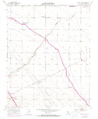
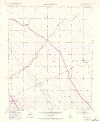
1955 Map of Chaney Ranch
USGS Topo · Published 1972About this map
Panoche Creek meanders through this agricultural section of Fresno County, providing a natural contrast to the grid of roads and industrial infrastructure that defined the region in the mid-20th century. The landscape is dominated by large-scale ranching and early water management systems, notably the California Aqueduct, which was added during the 1971 photorevision to show the evolving irrigation network of the San Joaquin Valley.
Find a feature on this map
19 named features on this map. Tap any name to fly to it.
Don’t see what you’re looking for? This feature index may not catch every label — zoom into the map to look around manually.
Map Details
Editions of this 1955 Chaney Ranch Map
5 editions found
Other maps of this area

1913 · Panoche
USGS Topo · 1:125,000

1921 · Tierra Loma School
USGS Topo · 1:31,680

1922 · Tufts Ranch
USGS Topo · 1:31,680

1922 · Chaney Ranch
USGS Topo · 1:31,680

1923 · Levis
USGS Topo · 1:31,680

1923 · Wisdom Well
USGS Topo · 1:31,680

1923 · Firebaugh
USGS Topo · 1:31,680

1923 · Tierra Loma School
USGS Topo · 1:31,680

1923 · Little Panoche
USGS Topo · 1:31,680

1923 · Monocline Ridge
USGS Topo · 1:31,680