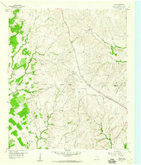
1958 Map of Chapin
USGS Topo · Published 1960About this map
The rolling prairies of the Parker Co Hood Co border land are defined here by cattle ranching and early transportation corridors in the late 1950s. The settlement of Chapin sits near the tracks of the Gulf Colorado and Santa Fe railroad, while an Old Railroad Grade further north traces an abandoned alignment across the landscape. The map highlights the area's rural character, dominated by large properties like the Double L Ranch and Cresson Ranch.
Find a feature on this map
23 named features on this map. Tap any name to fly to it.
Don’t see what you’re looking for? This feature index may not catch every label — zoom into the map to look around manually.
Map Details
Editions of this 1958 Chapin Map
Other maps of this area

1889 · Granbury
USGS Topo · 1:125,000

1891 · Weatherford
USGS Topo · 1:125,000

1893 · Weatherford
USGS Topo · 1:125,000

1923 · Granbury 2-a
USGS Topo · 1:48,000

1923 · Granbury 1-b
USGS Topo · 1:48,000

1924 · Weatherford 3-d
USGS Topo · 1:48,000

1928 · Godley
USGS Topo · 1:62,500

1931 · Dennis
USGS Topo · 1:62,500

1931 · Tolar
USGS Topo · 1:62,500

1954 · Dallas
USGS Topo · 1:250,000