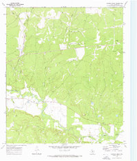
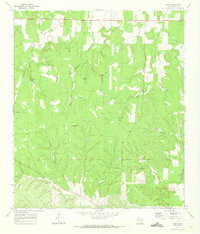
1970 Map of Chapman Draw
USGS Topo · Published 1973About this map
The San Saba River meanders across the southern portion of this landscape, its course marked by historical fords including Fivemile Crossing and Tenmile Crossing. In the early 1970s, the region's agricultural dependency is clearly signaled by the Menard Irrigation Company Canal, which runs parallel to the river. The northern terrain is defined by a dense network of seasonal drainage channels, most notably Chapman Draw, Mann Draw, and the curiously named 160 Acre Draw. Transport and topographic elevation are anchored by the Atchison Topeka and Santa Fe Creek rail corridor in the west and Hyman Hill in the east. This survey documents the intersection of essential water management and transit routes through the Texas Hill Country, preserving the locations of several Gravel Pits that reflect local industrial activity during this period.
Find a feature on this map
16 named features on this map. Tap any name to fly to it.
Don’t see what you’re looking for? This feature index may not catch every label — zoom into the map to look around manually.
Map Details
Editions of this 1970 Chapman Draw Map
Other maps of this area

1892 · Eden
USGS Topo · 1:125,000

1896 · Eden
USGS Topo · 1:125,000

1954 · Brownwood
USGS Topo · 1:250,000

1954 · Llano
USGS Topo · 1:250,000

1955 · Llano
USGS Topo · 1:250,000

1956 · Llano
USGS Topo · 1:250,000

1970 · Callan
USGS Topo · 1:24,000
1970 · Needle Creek
USGS Topo · 1:24,000

1970 · East Elm Creek
USGS Topo · 1:24,000
1970 · Hext
USGS Topo · 1:24,000