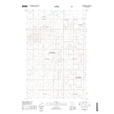
2020 Map of Charbonneau
USGS Topo · Published 2020About this map
Charbonneau serves as the focal point for this section of McKenzie County, North Dakota, situated within a vast landscape managed by the Little Missouri National Grassland. The terrain is defined by the dendritic patterns of numerous waterways, including Charbonneau Creek, Antelope Creek, and Lonesome Creek, which carve through the plains. The presence of Bull Butte provides a significant topographic reference point in a region otherwise characterized by its undulating agricultural and grazing lands.
Find a feature on this map
25 named features on this map. Tap any name to fly to it.
Don’t see what you’re looking for? This feature index may not catch every label — zoom into the map to look around manually.
Map Details
Editions of this 2020 Charbonneau Map
This is the sole edition of this map. No revisions or reprints were ever made.
Other maps of this area

1953 · Watford City
USGS Topo · 1:250,000

1957 · Watford City
USGS Topo · 1:250,000

1967 · Watford City
USGS Topo · 1:250,000
1968 · Buford
USGS Topo · 1:24,000

1969 · Cartwright NE
USGS Topo · 1:24,000

1972 · Alexander
USGS Topo · 1:24,000

1972 · Horse Creek School
USGS Topo · 1:24,000

1972 · Moline School
USGS Topo · 1:24,000

1972 · Charbonneau
USGS Topo · 1:24,000

1972 · Sather Lake
USGS Topo · 1:24,000