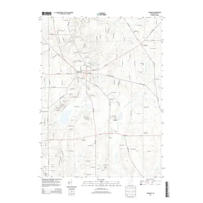
2013 Map of Chardon
USGS Topo · Published 2013About this map
Chardon serves as the central hub of this northern Ohio landscape, where the headwaters of several significant drainage systems begin their descent. The terrain is defined by the continental divide between the Chagrin River and East Br Chagrin River flowing toward Lake Erie, and the West Br Cuyahoga River, Butternut Cr, and Hopsons Cr which feed the Cuyahoga system. This transition is marked by prominent elevations like Ballards Hill and Woodin Hill.
Find a feature on this map
135 named features on this map. Tap any name to fly to it.
Don’t see what you’re looking for? This feature index may not catch every label — zoom into the map to look around manually.
Map Details
Editions of this 2013 Chardon Map
This is the sole edition of this map. No revisions or reprints were ever made.
Other maps of this area

1904 · Chardon
USGS Topo · 1:62,500

1905 · Garrettsville
USGS Topo · 1:62,500

1905 · Mentor
USGS Topo · 1:62,500

1906 · Chardon
USGS Topo · 1:62,500

1906 · Chagrin Falls
USGS Topo · 1:62,500

1907 · Garrettsville
USGS Topo · 1:62,500

1907 · Mentor
USGS Topo · 1:62,500

1908 · Chagrin Falls
USGS Topo · 1:62,500

1950 · Cleveland
USGS Topo · 1:250,000

1953 · Chardon
USGS Topo · 1:24,000