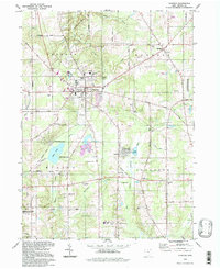
1994 Map of Chardon
USGS Topo · Published 1997About this map
Chardon serves as the focal point of this 1990s survey, situated within the historic Connecticut Western Reserve. The landscape is a mosaic of conservation and community life, defined by the Aquilla Lake Wildlife Area and the waters of Lake Aquilla. A distinct sense of local history is preserved in the numerous family and community sites, such as the Pitkin Cem and the Sisters of Notre Dame Educational Center.
Find a feature on this map
70 named features on this map. Tap any name to fly to it.
Don’t see what you’re looking for? This feature index may not catch every label — zoom into the map to look around manually.
Map Details
Editions of this 1994 Chardon Map
This is the sole edition of this map. No revisions or reprints were ever made.
Other maps of this area

1904 · Chardon
USGS Topo · 1:62,500

1905 · Garrettsville
USGS Topo · 1:62,500

1905 · Mentor
USGS Topo · 1:62,500

1906 · Chardon
USGS Topo · 1:62,500

1906 · Chagrin Falls
USGS Topo · 1:62,500

1907 · Garrettsville
USGS Topo · 1:62,500

1907 · Mentor
USGS Topo · 1:62,500

1908 · Chagrin Falls
USGS Topo · 1:62,500

1950 · Cleveland
USGS Topo · 1:250,000

1953 · Chardon
USGS Topo · 1:24,000