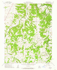
1961 Map of Charity
USGS Topo · Published 1962About this map
The Niangua River winds through the northeast corner of this Dallas County landscape, defining the topography of a region divided into the townships of South Benton, Wilson, Jackson, and Washington. Small agricultural settlements like Charity and March anchor the southern half of the map, while Spring Grove sits near the center. The map reveals a high density of rural social infrastructure, with numerous country churches such as Macedonia Ch and Mt Pleasant Ch No 1, alongside the Charity Sch and Mt Harmon Sch.
Find a feature on this map
33 named features on this map. Tap any name to fly to it.
Don’t see what you’re looking for? This feature index may not catch every label — zoom into the map to look around manually.
Map Details
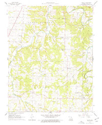
Editions of this 1961 Charity Map
2 editions found
Other maps of this area

1884 · Springfield
USGS Topo · 1:125,000

1884 · Bolivar
USGS Topo · 1:125,000

1886 · Springfield
USGS Topo · 1:125,000

1892 · Bolivar
USGS Topo · 1:125,000

1939 · Long Lane
USGS Topo · 1:62,500

1942 · Long Lane
USGS Topo · 1:62,500

1946 · Niangua
USGS Topo · 1:62,500

1947 · Strafford
USGS Topo · 1:62,500

1948 · Niangua
USGS Topo · 1:62,500

1948 · Strafford
USGS Topo · 1:62,500