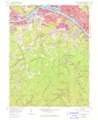
1958 Map of Charleston West
USGS Topo · Published 1973About this map
Industrial and educational growth along the Kanawha River defines the landscape during the mid-century development of the state capital region. The massive Naval Ordnance Plant in South Charleston stands as a primary landmark, reflecting the area's strategic manufacturing importance. Residential expansion is visible in neighborhoods like Forest Hills and South Hills, while the presence of numerous neighborhood facilities, including Roxalana Sch, O'Dell Sch, and Jefferson Jr High Sch, illustrates the density of the post-war community.
Find a feature on this map
101 named features on this map. Tap any name to fly to it.
Don’t see what you’re looking for? This feature index may not catch every label — zoom into the map to look around manually.
Map Details
Editions of this 1958 Charleston West Map
4 editions found
Other maps of this area

1899 · Charleston
USGS Topo · 1:125,000

1909 · Charleston
USGS Topo · 1:62,500

1909 · Peytona
USGS Topo · 1:48,000

1909 · Saint Albans
USGS Topo · 1:62,500

1911 · Peytona
USGS Topo · 1:62,500

1911 · Madison
USGS Topo · 1:62,500

1929 · Madison
USGS Topo · 1:62,500

1929 · Peytona
USGS Topo · 1:62,500

1931 · Madison
USGS Topo · 1:62,500

1931 · Saint Albans
USGS Topo · 1:62,500