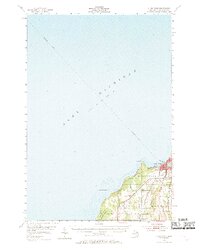
1954 Map of Charlevoix
USGS Topo · Published 1969About this map
Lake Michigan dominates this mid-century survey, defining the coastal identity of the region where the Pine R connects the open waters to Round L. The city of Charlevoix sits at this critical intersection, serving as a hub for both maritime and rail activity. The Chesapeake and Ohio railroad line hugs the eastern shore of the interior waters, supporting the local economy alongside several Gravel Pits and the nearby Charlevoix Airport.
Find a feature on this map
23 named features on this map. Tap any name to fly to it.
Don’t see what you’re looking for? This feature index may not catch every label — zoom into the map to look around manually.
Map Details
Editions of this 1954 Charlevoix Map
3 editions found
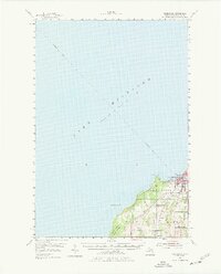
Other maps of this area

1954 · Central Lake
USGS Topo · 1:62,500

1954 · Charlevoix
USGS Topo · 1:62,500

1955 · Cheboygan
USGS Topo · 1:250,000

1956 · Beaver Island
USGS Topo · 1:62,500

1957 · Northport
USGS Topo · 1:62,500

1958 · Cheboygan
USGS Topo · 1:250,000

1958 · Cross Village
USGS Topo · 1:62,500

1958 · Bayshore
USGS Topo · 1:62,500

1961 · Boyne City
USGS Topo · 1:62,500

1975 · Boyne City NW
USGS Topo · 1:24,000