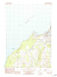
1983 Map of Charlevoix
USGS Topo · Published 1984About this map
Charlevoix serves as the focal point of this coastal landscape, situated where Round Lake meets the expansive waters of Lake Michigan. The town's maritime character is evident in the Breakwater and Serwall protecting the channel, while the local infrastructure includes a Municipal Airport and Townhall. Beyond the immediate harbor, the shoreline transitions to the natural reaches of Fishermans Island State Park, which encompasses Fisherman Island just offshore.
Find a feature on this map
37 named features on this map. Tap any name to fly to it.
Don’t see what you’re looking for? This feature index may not catch every label — zoom into the map to look around manually.
Map Details
Editions of this 1983 Charlevoix Map
This is the sole edition of this map. No revisions or reprints were ever made.
Other maps of this area

1954 · Central Lake
USGS Topo · 1:62,500

1954 · Charlevoix
USGS Topo · 1:62,500

1955 · Cheboygan
USGS Topo · 1:250,000

1958 · Cheboygan
USGS Topo · 1:250,000

1958 · Bayshore
USGS Topo · 1:62,500

1961 · Boyne City
USGS Topo · 1:62,500

1975 · Boyne City NW
USGS Topo · 1:24,000
1983 · Ellsworth
USGS Topo · 1:25,000
1983 · Atwood
USGS Topo · 1:24,000
1983 · Ironton
USGS Topo · 1:25,000