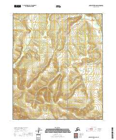
2018 Map of Charley River A-3 SW
USGS Topo · Published 2018About this map
Yukon-Charley Rivers National Preserve covers the vast interior of this region, protecting a landscape defined by its network of drainages in the Southeast Fairbanks Census Area. This 2018 survey illustrates the complex drainage systems of the upper Yukon river basin, where watercourses like Fisher Cr and Dome Cr carve through high-elevation terrain. The presence of Research Cr in the southwest and Washington Cr in the northeast highlights the watershed patterns that have dictated travel and seasonal movement through this territory for generations.
Find a feature on this map
10 named features on this map. Tap any name to fly to it.
Don’t see what you’re looking for? This feature index may not catch every label — zoom into the map to look around manually.
Map Details
Editions of this 2018 Charley River A-3 SW Map
This is the sole edition of this map. No revisions or reprints were ever made.
Other maps of this area

1951 · Charley River
USGS Topo · 1:250,000

1951 · Eagle
USGS Topo · 1:250,000

1956 · Charley River A-4
USGS Topo · 1:63,360

1956 · Charley River A-3
USGS Topo · 1:63,360

1956 · Charley River
USGS Topo · 1:250,000

1956 · Eagle D-3
USGS Topo · 1:63,360
1956 · Eagle D-4
USGS Topo · 1:63,360

1957 · Eagle
USGS Topo · 1:250,000
2018 · Charley River A-3 NE
USGS Topo · 1:25,000
2018 · Charley River A-4 NE
USGS Topo · 1:25,000