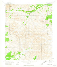
1956 Map of Eagle D-4
USGS Topo · Published 1965About this map
Mt Sorenson and Arctic Dome anchor this interior Alaskan terrain during the mid-1950s, a landscape defined by the drainage of the Seventymile River and its numerous tributaries. The map documents the intricate hydrography of the region, where the Diamond Fork meets the main river and smaller waterways like Flume Creek and Slate Creek carve through the elevation.
Find a feature on this map
12 named features on this map. Tap any name to fly to it.
Don’t see what you’re looking for? This feature index may not catch every label — zoom into the map to look around manually.
Map Details
Editions of this 1956 Eagle D-4 Map
2 editions found
Other maps of this area

1951 · Charley River
USGS Topo · 1:250,000

1951 · Eagle
USGS Topo · 1:250,000

1956 · Charley River A-5
USGS Topo · 1:63,360

1956 · Charley River A-4
USGS Topo · 1:63,360

1956 · Charley River A-3
USGS Topo · 1:63,360

1956 · Charley River
USGS Topo · 1:250,000

1956 · Eagle D-3
USGS Topo · 1:63,360

1956 · Eagle C-3
USGS Topo · 1:63,360
1956 · Eagle D-5
USGS Topo · 1:63,360

1956 · Eagle C-5
USGS Topo · 1:63,360