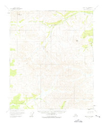
1956 Map of Eagle D-4
USGS Topo · Published 1975About this map
Seventymile River flows through this interior Alaskan wilderness, as it appeared during the mid-1950s. The landscape is defined by the high elevations of Mt Sorenson and Arctic Dome, with numerous drainages cutting through the terrain, including the Diamond Fork and the aptly named Rock Slide. Human presence is exceptionally sparse here, recorded only by the Cabin (Ruins) located in the southwest near the headwaters of Copper Creek. This survey reflects the remote character of the region before significant modern development, showing a land charted primarily by its watercourses like Flume Creek and Slate Creek. The inclusion of the Base Line across the center of the sheet highlights the early surveying efforts to organize this unsurveyed territory.
Find a feature on this map
13 named features on this map. Tap any name to fly to it.
Don’t see what you’re looking for? This feature index may not catch every label — zoom into the map to look around manually.
Map Details
Editions of this 1956 Eagle D-4 Map
2 editions found
Other maps of this area

1951 · Charley River
USGS Topo · 1:250,000

1951 · Eagle
USGS Topo · 1:250,000

1956 · Charley River A-5
USGS Topo · 1:63,360

1956 · Charley River A-4
USGS Topo · 1:63,360

1956 · Charley River A-3
USGS Topo · 1:63,360

1956 · Charley River
USGS Topo · 1:250,000

1956 · Eagle D-3
USGS Topo · 1:63,360

1956 · Eagle C-3
USGS Topo · 1:63,360
1956 · Eagle D-5
USGS Topo · 1:63,360
1956 · Eagle D-4
USGS Topo · 1:63,360