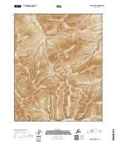
2018 Map of Charley River D-2 SE
USGS Topo · Published 2018About this map
Steep, high-elevation terrain characterizes this remote section of the Yukon-Koyukuk region, where the landscape is defined by its dramatic relief and lack of named settlements. The 2018 survey reveals a wilderness area subdivided by the Public Land Survey System into T12n R29e, T12n R30e, T11n R29e, and T11n R30e. Without any printed names for peaks or watercourses, the map serves as a pure topographical study of the interior, showing tight contour lines that denote sharp ridgelines and deep unmapped drainages. This is a primary resource for understanding the literal lay of the land in one of the most secluded parts of the Charley River drainage, providing the raw physical data of the earth's surface before human nomenclature was formally recorded on these USGS sheets.
Find a feature on this map
4 named features on this map. Tap any name to fly to it.
Don’t see what you’re looking for? This feature index may not catch every label — zoom into the map to look around manually.
Map Details
Editions of this 2018 Charley River D-2 SE Map
This is the sole edition of this map. No revisions or reprints were ever made.
Other maps of this area

1951 · Charley River
USGS Topo · 1:250,000

1956 · Charley River C-2
USGS Topo · 1:63,360
1956 · Charley River C-1
USGS Topo · 1:63,360

1956 · Charley River D-2
USGS Topo · 1:63,360
1956 · Charley River D-1
USGS Topo · 1:63,360

1956 · Charley River
USGS Topo · 1:250,000
2018 · Charley River D-1 SW
USGS Topo · 1:25,000
2018 · Charley River D-1 NW
USGS Topo · 1:25,000
2018 · Charley River C-1 NW
USGS Topo · 1:25,000
2018 · Charley River D-2 SW
USGS Topo · 1:25,000