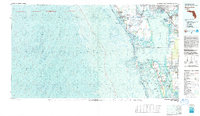
1981 Map of Charlotte Harbor
USGS Topo · Published 1983About this map
Punta Gorda and the burgeoning developments of Port Charlotte anchor this topographic-bathymetric study of the southwest Florida coast in the early 1980s. The map illustrates a transitional era for the region, where the planned circular street pattern of Rotonda West and the residential expansion of Cape Coral contrast with the protected barrier islands. Extensive hydrographic data reveals the depths and shoals of Charlotte Harbor, Pine Island Sound, and the Myakka River. Significant conservation areas are clearly delineated, including the Cayo Costa State Preserve and several national wildlife refuges, preserving the character of the keys before modern intensification. The Seaboard Coast Line railroad provides a historical land-link across the landscape, connecting coastal settlements like El Jobean and Solana to the interior, while the bathymetric contours offer a precise view of the underwater topography critical to the local maritime economy.
Find a feature on this map
45 named features on this map. Tap any name to fly to it.
Don’t see what you’re looking for? This feature index may not catch every label — zoom into the map to look around manually.
Map Details
Editions of this 1981 Charlotte Harbor Map
This is the sole edition of this map. No revisions or reprints were ever made.
Other maps of this area

1944 · Myakka River
USGS Topo · 1:31,680

1944 · Venice
USGS Topo · 1:31,680

1956 · Murdock
USGS Topo · 1:24,000

1956 · Murdock SE
USGS Topo · 1:24,000

1956 · Cleveland
USGS Topo · 1:24,000

1956 · Ft. Ogden
USGS Topo · 1:24,000

1956 · Punta Gorda SE
USGS Topo · 1:24,000

1956 · Englewood
USGS Topo · 1:24,000

1956 · West Palm Beach
USGS Topo · 1:250,000

1956 · Tampa
USGS Topo · 1:250,000