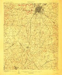
1907 Map of Charlotte
USGS Topo · Published 1907About this map
Charlotte is captured here as a compact urban grid surrounded by sprawling agricultural townships and rural settlements at the start of the twentieth century. The red boundary of Camp Greene provides a striking visual reference for this military installation situated just west of the city center. Radiating from the hub of Dilworth and Biddleville, a network of historical thoroughfares including Tuckasegee Road and Beattys Ford Road connects the town to outlying communities. The landscape is heavily dotted with family-centered landmarks such as Steel Creek Church, Kendrick Crossroads, and Kell School. To the south, the Catawba River forms the natural border between North Carolina and South Carolina, where the town of Fort Mill sits at the intersection of the Southern Railroad and local trade routes, illustrating the region's reliance on rail for commerce.
Find a feature on this map
97 named features on this map. Tap any name to fly to it.
Don’t see what you’re looking for? This feature index may not catch every label — zoom into the map to look around manually.
Map Details
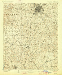
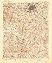
Editions of this 1907 Charlotte Map
4 editions found
Other maps of this area

1905 · Charlotte
USGS Topo · 1:48,000

1907 · Charlotte
USGS Topo · 1:62,500

1914 · Gastonia
USGS Topo · 1:48,000

1916 · Gastonia
USGS Topo · 1:62,500

1941 · Charlotte
USGS Topo · 1:125,000

1941 · Spartanburg
USGS Topo · 1:250,000

1942 · Charlotte
USGS Topo · 1:125,000

1947 · Clover
USGS Topo · 1:62,500

1948 · Paw Creek
USGS Topo · 1:24,000

1948 · Derita
USGS Topo · 1:24,000