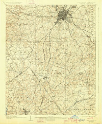
1907 Map of Charlotte
USGS Topo · Published 1926About this map
Charlotte is depicted here as a growing rail hub at the turn of the century, centered around its radiating street grid and the intersecting lines of the Southern Railway and Seaboard Air Line. Beyond the city limits, the map reveals a dense network of rural communities and crossroads defined by early academic and religious centers, such as Elizabeth College and a high concentration of Presbyterian and Methodist congregations including Steel Creek Church and Providence Church. The landscape is etched by numerous drainage basins, with Sugar Creek and Little Sugar Creek flowing southward toward the Catawba River across the state line into South Carolina. In the southern portion of the survey, the industrial character of the era is evident in Pineville and Fort Mill, which were emerging as significant textile manufacturing centers. For local historians, the sheet is exceptionally detailed in its naming of small rural hubs like Shopton, Sardis, and Biddleville, alongside family-named landmarks such as Coopers Store and Robinsons Store.
Find a feature on this map
99 named features on this map. Tap any name to fly to it.
Don’t see what you’re looking for? This feature index may not catch every label — zoom into the map to look around manually.
Map Details
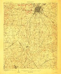
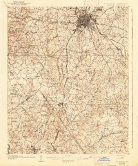
Editions of this 1907 Charlotte Map
4 editions found
Other maps of this area

1905 · Charlotte
USGS Topo · 1:48,000

1907 · Charlotte
USGS Topo · 1:62,500

1914 · Gastonia
USGS Topo · 1:48,000

1916 · Gastonia
USGS Topo · 1:62,500

1941 · Charlotte
USGS Topo · 1:125,000

1941 · Spartanburg
USGS Topo · 1:250,000

1942 · Charlotte
USGS Topo · 1:125,000

1947 · Clover
USGS Topo · 1:62,500

1948 · Paw Creek
USGS Topo · 1:24,000

1948 · Derita
USGS Topo · 1:24,000