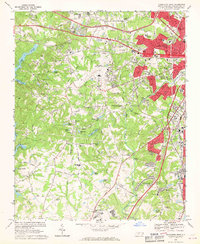
1968 Map of Charlotte West
USGS Topo · Published 1970About this map
Douglas Municipal Airport dominates the center of this 1968 study, showing its configuration alongside the National Guard base before the modern expansion of the Queen City. The western edge of Charlotte is captured during a period of rapid suburbanization, with residential developments encroaching on older rural crossroads like Dixie and Shopton. The landscape is a mix of evolving infrastructure and traditional landmarks, including the historic Steele Creek Ch and several smaller community sites like Mt Olive Ch and Berryhill Cem.
Find a feature on this map
81 named features on this map. Tap any name to fly to it.
Don’t see what you’re looking for? This feature index may not catch every label — zoom into the map to look around manually.
Map Details
Editions of this 1968 Charlotte West Map
3 editions found
Other maps of this area

1905 · Charlotte
USGS Topo · 1:48,000

1907 · Charlotte
USGS Topo · 1:62,500

1914 · Gastonia
USGS Topo · 1:48,000

1916 · Gastonia
USGS Topo · 1:62,500

1941 · Charlotte
USGS Topo · 1:125,000

1942 · Charlotte
USGS Topo · 1:125,000

1947 · Clover
USGS Topo · 1:62,500

1948 · Paw Creek
USGS Topo · 1:24,000

1948 · Derita
USGS Topo · 1:24,000

1948 · Charlotte East
USGS Topo · 1:24,000