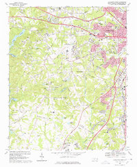
1968 Map of Charlotte West
USGS Topo · Published 1978About this map
Douglas Municipal Airport dominates the central landscape of this western Mecklenburg County study, reflecting Charlotte's mid-century expansion into a regional transportation hub. The surrounding rural-urban fringe is defined by a dense network of water bodies such as Lake Wylie and Sugar Creek, interspersed with numerous private airfields like Carpenter Airport and various radio facilities. The map documents a significant era of educational infrastructure development, featuring numerous secondary schools including Harding High Sch and West Mecklenburg High Sch.
Find a feature on this map
73 named features on this map. Tap any name to fly to it.
Don’t see what you’re looking for? This feature index may not catch every label — zoom into the map to look around manually.
Map Details
Editions of this 1968 Charlotte West Map
3 editions found
Other maps of this area

1905 · Charlotte
USGS Topo · 1:48,000

1907 · Charlotte
USGS Topo · 1:62,500

1914 · Gastonia
USGS Topo · 1:48,000

1916 · Gastonia
USGS Topo · 1:62,500

1941 · Charlotte
USGS Topo · 1:125,000

1942 · Charlotte
USGS Topo · 1:125,000

1947 · Clover
USGS Topo · 1:62,500

1948 · Paw Creek
USGS Topo · 1:24,000

1948 · Derita
USGS Topo · 1:24,000

1948 · Charlotte East
USGS Topo · 1:24,000