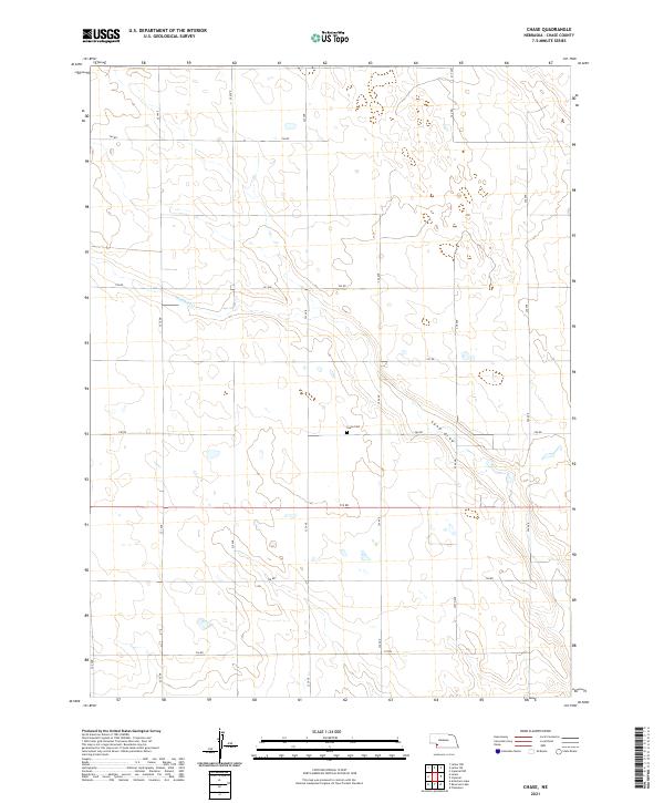
2021 Map of Chase
USGS Topo · Published 2021About this map
Chase Cem stands as a focal point of this rural landscape in the southwestern Nebraska plains, situated near the intersection of 740 RD and 323 Ave. The terrain is characterized by the subtle drainage patterns of Wildhorse Cr in the northwest and the winding path of Sand Draw to the east. These seasonal watercourses dictate the local topography, which is largely organized by the rigid grid of the Public Land Survey System, encompassing portions of townships t8n r40w through t6n r39w. The map reveals a high plains environment where development is sparse, primarily consisting of a network of section-line roads such as 744 RD and 326 Ave that serve the agricultural interests of the region.
Find a feature on this map
24 named features on this map. Tap any name to fly to it.
Don’t see what you’re looking for? This feature index may not catch every label — zoom into the map to look around manually.
Map Details
Editions of this 2021 Chase Map
This is the sole edition of this map. No revisions or reprints were ever made.
Other maps of this area

1954 · McCook
USGS Topo · 1:250,000

1957 · McCook
USGS Topo · 1:250,000

1958 · McCook
USGS Topo · 1:250,000

1961 · Lamar NE
USGS Topo · 1:24,000

1961 · Lamar
USGS Topo · 1:24,000

1961 · Lamar NW
USGS Topo · 1:24,000

1973 · Champion
USGS Topo · 1:24,000
1973 · Lamar
USGS Topo · 1:24,000
1973 · Chase
USGS Topo · 1:24,000

1973 · Imperial
USGS Topo · 1:24,000