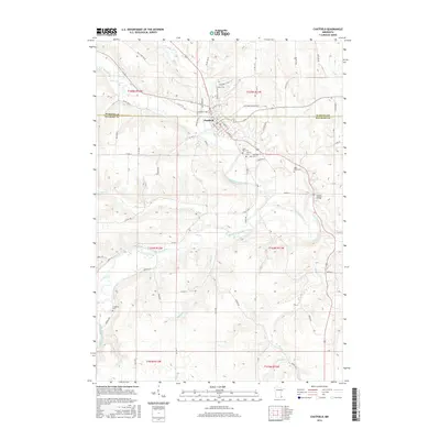
2016 Map of Chatfield
USGS Topo · Published 2016About this map
Chatfield sits at the confluence of several significant waterways, straddling the line between Olmsted and Fillmore counties. The town's layout is closely tied to the winding path of Mill Cr, which flows into the North Branch Root River. The surrounding rural landscape is defined by a dense network of river branches and creeks, including the Middle Branch Root River, Bear Cr, and Shady Cr, creating a complex drainage system that has historically shaped agricultural boundaries and transportation routes in this part of southeastern Minnesota.
Find a feature on this map
54 named features on this map. Tap any name to fly to it.
Don’t see what you’re looking for? This feature index may not catch every label — zoom into the map to look around manually.
Map Details
Editions of this 2016 Chatfield Map
This is the sole edition of this map. No revisions or reprints were ever made.
Other maps of this area

1954 · Chatfield
USGS Topo · 1:62,500

1954 · Mason City
USGS Topo · 1:250,000

1955 · Stewartville
USGS Topo · 1:62,500

1957 · Mason City
USGS Topo · 1:250,000

1958 · Mason City
USGS Topo · 1:250,000

1965 · Wykoff
USGS Topo · 1:24,000

1965 · Fountain
USGS Topo · 1:24,000
1965 · Preston
USGS Topo · 1:24,000
1974 · Pilot Mound
USGS Topo · 1:24,000
1974 · Marion
USGS Topo · 1:24,000