1974 Map of Chatfield
USGS Topo · Published 1976About this map
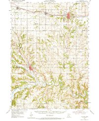
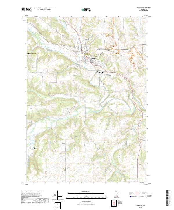
Chatfield sits at the junction of several key watercourses in southeastern Minnesota, where Mill Creek and the North Branch Root River converge. This mid-1970s survey illustrates a landscape defined by its deep river valleys and the Minnesota Memorial Hardwood State Forest, which blankets the wooded bluffs and ridges. Several burial grounds, including St Paul Cem, Calvary Cem, and Chatfield Cemetery, are clustered just southeast of the town center, providing a clear record of the area's established local history. The map also documents specific land uses of the era, from the Chosen Valley Golf Course and Roadside Park near the river to the private Kohlmeyer Landing Strip further south. Geologic and industrial activity is noted via several Quarry sites dotting the higher elevations between the drainage basins of Bear Creek and the Middle Branch Root River.
Find a feature on this map
30 named features on this map. Tap any name to fly to it.
Don’t see what you’re looking for? This feature index may not catch every label — zoom into the map to look around manually.
Map Details
Editions of this 1974 Chatfield Map
This is the sole edition of this map. No revisions or reprints were ever made.
Historical Maps of Chatfield Through Time
7 maps found