
1961 Map of Chatfield
USGS Topo · Published 1966About this map
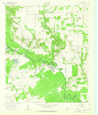
The Corsicana Oil Field dominates the landscape of northeast Navarro County in the early 1960s, evidenced by a dense network of Oil Wells and a major Pipeline cutting through the terrain. This petroleum infrastructure shares the land with a complex water management system featuring the Rice Drainage Ditch and numerous numeric reservoirs like Reservoir No 128, reflecting the agricultural demands of the Chambers Creek bottomlands.
Find a feature on this map
42 named features on this map. Tap any name to fly to it.
Don’t see what you’re looking for? This feature index may not catch every label — zoom into the map to look around manually.
Map Details
Editions of this 1961 Chatfield Map
This is the sole edition of this map. No revisions or reprints were ever made.
Other maps of this area

1954 · Dallas
USGS Topo · 1:250,000

1956 · Ennis
USGS Topo · 1:62,500

1958 · Dallas
USGS Topo · 1:250,000

1959 · Powell
USGS Topo · 1:24,000

1962 · Bazette
USGS Topo · 1:24,000

1962 · Emhouse
USGS Topo · 1:24,000

1962 · Ennis East
USGS Topo · 1:24,000

1962 · Rosser SW
USGS Topo · 1:24,000
1962 · Styx
USGS Topo · 1:24,000
1965 · Corsicana
USGS Topo · 1:24,000