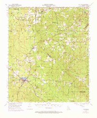
1953 Map of Chatham
USGS Topo · Published 1973About this map
The town of Chatham and the waters of Chatham Lake anchor this mid-century look at the borders of Lincoln, Jackson, Quachita, and Caldwell Parishes. This is a landscape shaped by transportation and water, where the Illinois Central Railroad cuts across the terrain, passing through Eros and reaching Wood Junction. To the south, an Old Railroad Grade hints at a changing network of transit through the piney woods and creek bottoms.
Find a feature on this map
79 named features on this map. Tap any name to fly to it.
Don’t see what you’re looking for? This feature index may not catch every label — zoom into the map to look around manually.
Map Details
Editions of this 1953 Chatham Map
3 editions found
Other maps of this area

1935 · Drew
USGS Topo · 1:62,500

1940 · Monroe
USGS Topo · 1:62,500

1940 · Columbia
USGS Topo · 1:62,500

1949 · Jonesboro
USGS Topo · 1:62,500

1950 · Jonesboro
USGS Topo · 1:62,500

1950 · Ruston
USGS Topo · 1:62,500

1951 · Ruston
USGS Topo · 1:62,500

1952 · Calhoun
USGS Topo · 1:62,500

1953 · Chatham
USGS Topo · 1:62,500

1953 · Hodge
USGS Topo · 1:62,500