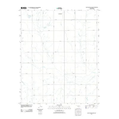
2012 Map of Chattanooga SW
USGS Topo · Published 2012About this map
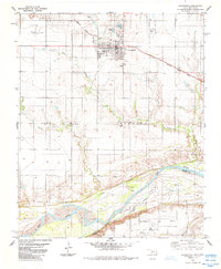
Chattanooga Sky Harbor Airport anchors the northern portion of this Tillman County landscape, serving as a distinct aeronautical landmark amidst a structured grid of rural section roads. The terrain is defined by the winding paths of Deep Red Cr and its tributary, Little Deep Red Cr, which meander through the southern half of the quadrangle. Water management is a visible priority in this part of Oklahoma, evidenced by the Jack Cr Site 7 Reservoir and Jack Cr Site 5 Reservoir positioned along the upper reaches of Jack Cr. This 2012 survey illustrates the enduring agricultural layout of the region, where a dense network of numbered routes such as e1850 RD and n2400 RD provide access to the expansive ranching and farming tracts that have sustained the area since its early settlement.
Find a feature on this map
22 named features on this map. Tap any name to fly to it.
Don’t see what you’re looking for? This feature index may not catch every label — zoom into the map to look around manually.
Map Details
Editions of this 2012 Chattanooga SW Map
This is the sole edition of this map. No revisions or reprints were ever made.
Other maps of this area

1955 · Lawton
USGS Topo · 1:250,000

1957 · Burkburnett
USGS Topo · 1:62,500

1958 · Electra
USGS Topo · 1:62,500

1962 · Chattanooga
USGS Topo · 1:62,500
1974 · Hollister
USGS Topo · 1:24,000
1974 · Hollister NE
USGS Topo · 1:24,000
1985 · Augur Creek
USGS Topo · 1:24,000
1985 · Grandfield
USGS Topo · 1:24,000
1985 · Devol
USGS Topo · 1:24,000

1985 · Burkburnett
USGS Topo · 1:100,000