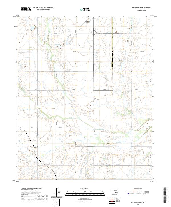
2022 Map of Chattanooga SW
USGS Topo · Published 2022About this map
The agricultural plains at the border of Tillman Co and Cotton Co are defined by a complex drainage network that feeds into the Red River watershed. The modern landscape is etched with an orderly grid of section-line roads, such as E1850 Rd and N2410 Rd, which navigate the winding paths of Deep Red Cr and Little Deep Red Cr. A notable landmark in this rural expanse is the Chattanooga Sky Harbor Airport, situated near the northern edge of the survey area. Water management is evident through features like the Jack Cr Site 7 Reservoir, which captures the flow of Jack Cr. The map illustrates a contemporary balance between wide-scale ranching or farming and the specialized infrastructure required for aviation and local water conservation.
Find a feature on this map
32 named features on this map. Tap any name to fly to it.
Don’t see what you’re looking for? This feature index may not catch every label — zoom into the map to look around manually.
Map Details
Editions of this 2022 Chattanooga SW Map
This is the sole edition of this map. No revisions or reprints were ever made.
Other maps of this area

1955 · Lawton
USGS Topo · 1:250,000

1957 · Burkburnett
USGS Topo · 1:62,500

1958 · Electra
USGS Topo · 1:62,500

1962 · Chattanooga
USGS Topo · 1:62,500
1974 · Hollister
USGS Topo · 1:24,000
1974 · Hollister NE
USGS Topo · 1:24,000
1985 · Augur Creek
USGS Topo · 1:24,000
1985 · Grandfield
USGS Topo · 1:24,000
1985 · Devol
USGS Topo · 1:24,000

1985 · Burkburnett
USGS Topo · 1:100,000