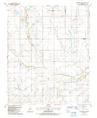
1987 Map of Chattanooga SW
USGS Topo · Published 1988About this map
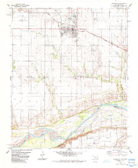
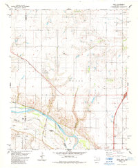
Chattanooga Sky Harbor and the surrounding agricultural lands of Tillman and Cotton counties are captured in this late-1980s landscape. The terrain is defined by the convergence of several major watercourses, most notably Deep Red Creek and Little Deep Red Creek, which meander through the southern half of the quadrangle. Transport and industrial activity are evident through the route of the Missouri-Kansas-Texas railroad line passing through the settlement of Loveland. This area of Oklahoma is characterized by its resource extraction and aviation infrastructure, with numerous Gravel Pits scattered across the township lines and a prominent Water Tank marking the central plains. The map provides a clear view of the rural section lines and township boundaries that organized Southwest Oklahoma's development.
Find a feature on this map
16 named features on this map. Tap any name to fly to it.
Don’t see what you’re looking for? This feature index may not catch every label — zoom into the map to look around manually.
Map Details
Editions of this 1987 Chattanooga SW Map
This is the sole edition of this map. No revisions or reprints were ever made.
Other maps of this area

1955 · Lawton
USGS Topo · 1:250,000

1957 · Burkburnett
USGS Topo · 1:62,500

1958 · Electra
USGS Topo · 1:62,500

1962 · Chattanooga
USGS Topo · 1:62,500
1974 · Hollister
USGS Topo · 1:24,000
1974 · Hollister NE
USGS Topo · 1:24,000
1985 · Augur Creek
USGS Topo · 1:24,000
1985 · Grandfield
USGS Topo · 1:24,000
1985 · Devol
USGS Topo · 1:24,000

1985 · Burkburnett
USGS Topo · 1:100,000