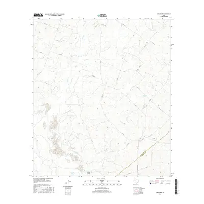
2016 Map of Cheapside
USGS Topo · Published 2016About this map
Cheapside sits at the intersection of local routes in a landscape defined by the drainage systems of southern Gonzales and northern DeWitt counties. This survey shows the area's rural character, where small family-named cemeteries such as Gates Cem and Mount Enon Cem serve as long-standing markers of early Texas settlement patterns. The topography is shaped by various waterways, including the winding course of Five Mile Cr and Sandies Cr, which create the low-lying basins for McMannis Lake and Hickory Lake. The terrain transitions from the broader valleys of Howell Hollow to the smaller tributaries of Brushy Cr and Salty Cr, reflecting the agricultural and ranching history that has sustained this portion of the coastal plains for generations.
Find a feature on this map
40 named features on this map. Tap any name to fly to it.
Don’t see what you’re looking for? This feature index may not catch every label — zoom into the map to look around manually.
Map Details
Editions of this 2016 Cheapside Map
This is the sole edition of this map. No revisions or reprints were ever made.
Other maps of this area

1920 · Smiley
USGS Topo · 1:125,000

1953 · Seguin
USGS Topo · 1:250,000

1958 · Seguin
USGS Topo · 1:250,000

1959 · Cost
USGS Topo · 1:24,000

1959 · Hochheim
USGS Topo · 1:24,000

1959 · Gonzales South
USGS Topo · 1:24,000

1959 · Hamon
USGS Topo · 1:24,000

1960 · Concrete
USGS Topo · 1:24,000

1960 · Cheapside
USGS Topo · 1:24,000

1960 · Westhoff
USGS Topo · 1:24,000