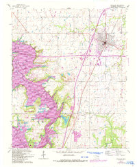
1963 Map of Checotah
USGS Topo · Published 1993About this map
The town of Checotah stands as a rail and highway hub in this mid-century survey, updated in the early 1990s to reflect modern infrastructure. The Missouri-Kansas-Texas RR corridor bisects the community, which is flanked by the newer Indian Nation Turnpike and Interstate 40. Southwest of town, the landscape transitions into the waters of Eufaula Lake, where the Deep Fork and North Canadian River arms meet. This map illustrates the intersection of traditional settlements like Onapa and historic sites such as Green Lawn Cemetery with 20th-century recreational development. The establishment of Fountainhead State Park, complete with its Golf Course and the Fountainhead Lodge, highlights the region's shift toward a tourism-based economy following the inundation of the river valleys.
Find a feature on this map
21 named features on this map. Tap any name to fly to it.
Don’t see what you’re looking for? This feature index may not catch every label — zoom into the map to look around manually.
Map Details
Editions of this 1963 Checotah Map
3 editions found

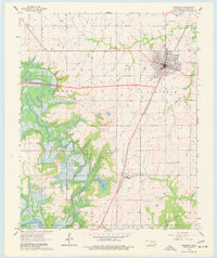
Other maps of this area

1896 · Okmulgee
USGS Topo · 1:125,000

1900 · Sansbois
USGS Topo · 1:125,000

1900 · Canadian
USGS Topo · 1:125,000

1900 · Okmulgee
USGS Topo · 1:125,000

1901 · Muscogee
USGS Topo · 1:125,000

1905 · Muscogee
USGS Topo · 1:125,000

1909 · Sans Bois
USGS Topo · 1:125,000

1911 · Sansbois
USGS Topo · 1:125,000

1946 · Fort Smith
USGS Topo · 1:250,000

1948 · Keefeton
USGS Topo · 1:62,500