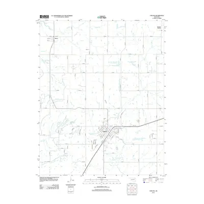
2013 Map of Chelsea
USGS Topo · Published 2013About this map
Chelsea and the surrounding Rogers County prairie are documented here during a period of modern agricultural and water management. The town of Chelsea serves as a central hub, with its grid of streets such as Vine St and S Maple St radiating from a core near the railroad corridor. The surrounding landscape is defined by the Pryor Cr drainage system, which includes several man-made water features such as Pryor Creek Watershed Site 19 Reservoir and Chelsea Reservoir Number 2. These sites reflect the region's efforts to manage local hydrology for both livestock and municipal needs. To the north, the small settlement of Alluwe stands near the banks of Panther Cr, while local history is preserved at the Chelsea Cem and the Snider Cem.
Find a feature on this map
87 named features on this map. Tap any name to fly to it.
Don’t see what you’re looking for? This feature index may not catch every label — zoom into the map to look around manually.
Map Details
Editions of this 2013 Chelsea Map
This is the sole edition of this map. No revisions or reprints were ever made.
Other maps of this area

1896 · Pryor
USGS Topo · 1:125,000

1901 · Claremore
USGS Topo · 1:125,000

1901 · Nowata
USGS Topo · 1:125,000

1901 · Vinita
USGS Topo · 1:125,000

1901 · Pryor
USGS Topo · 1:125,000

1913 · Vinita
USGS Topo · 1:125,000

1914 · Nowata
USGS Topo · 1:125,000

1914 · Claremore
USGS Topo · 1:125,000

1916 · Claremore
USGS Topo · 1:125,000

1954 · Tulsa
USGS Topo · 1:250,000