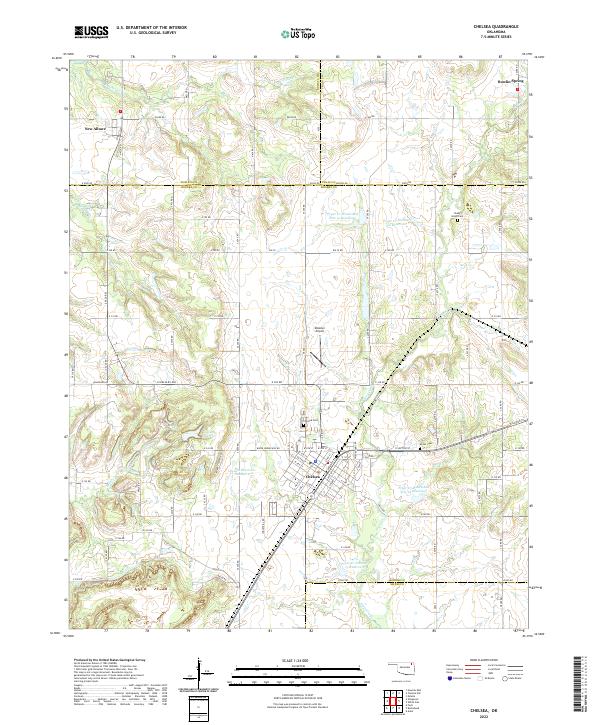
2022 Map of Chelsea
USGS Topo · Published 2022About this map
The town of Chelsea serves as the central hub of this Rogers County landscape, situated at the crossroads of local history and modern infrastructure. This 2022 survey documents the town's grid and surrounding rural character, including the Chelsea Cem and Delozier Airport. The geography is defined by a sophisticated system of water management, evidenced by the Chelsea Reservoir, Chelsea Reservoir Number 2, and various sites along the Pryor Cr watershed. To the north, the smaller settlements of New Alluwe and Bowlin Spring mark the shift toward more open terrain, where Panther Cr and Plumb Cr drain through the countryside. Genealogists will find interest in localized burial sites like Snider Cem and Shady Grove Cem, while the intricate network of county roads reflects the enduring agricultural and residential patterns of northeast Oklahoma.
Find a feature on this map
55 named features on this map. Tap any name to fly to it.
Don’t see what you’re looking for? This feature index may not catch every label — zoom into the map to look around manually.
Map Details
Editions of this 2022 Chelsea Map
This is the sole edition of this map. No revisions or reprints were ever made.
Other maps of this area

1896 · Pryor
USGS Topo · 1:125,000

1901 · Claremore
USGS Topo · 1:125,000

1901 · Nowata
USGS Topo · 1:125,000

1901 · Vinita
USGS Topo · 1:125,000

1901 · Pryor
USGS Topo · 1:125,000

1913 · Vinita
USGS Topo · 1:125,000

1914 · Nowata
USGS Topo · 1:125,000

1914 · Claremore
USGS Topo · 1:125,000

1916 · Claremore
USGS Topo · 1:125,000

1954 · Tulsa
USGS Topo · 1:250,000