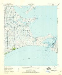
1951 Map of Cheniere Au Tigre
USGS Topo · Published 1960About this map
The settlement of Cheniere au Tigre sits along the Gulf Coast of Vermilion Parish, anchored by a low ridge between the marshes and the open water. This 1951 field check reveals an environment defined by massive conservation tracts, notably the Paul J Rainey Wildlife Sanctuary and the Russell Sage Foundation State Game Refuge. The intricate network of coastal waterways is documented through features like Southwest Pass and Schooner Bayou, which serve as vital arteries for both navigation and local drainage.
Find a feature on this map
47 named features on this map. Tap any name to fly to it.
Don’t see what you’re looking for? This feature index may not catch every label — zoom into the map to look around manually.
Map Details
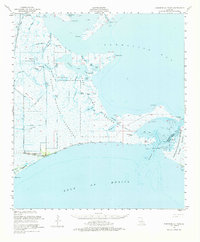
Editions of this 1951 Cheniere Au Tigre Map
3 editions found

Other maps of this area

1932 · Abbeville SW
USGS Topo · 1:31,680

1932 · Abbeville SE
USGS Topo · 1:31,680

1932 · Pecan Island SE
USGS Topo · 1:31,680

1937 · Derouen
USGS Topo · 1:62,500

1945 · New Orleans
USGS Topo · 1:250,000

1945 · Pecan Island NE
USGS Topo · 1:31,680

1946 · Redfish Point SW
USGS Topo · 1:31,680

1946 · Schooner Bayou SE
USGS Topo · 1:31,680

1946 · Redfish Point NE
USGS Topo · 1:31,680

1946 · Redfish Point SE
USGS Topo · 1:31,680