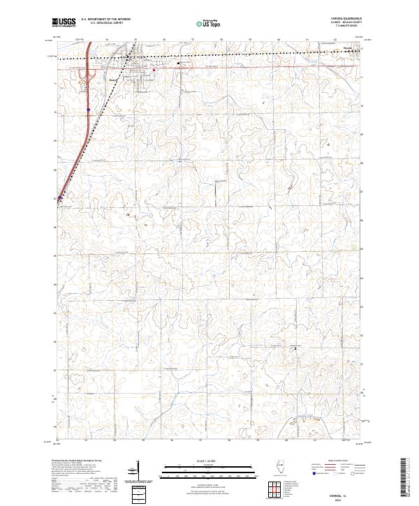
2024 Map of Chenoa
USGS Topo · Published 2024About this map
Chenoa anchors this McLean County landscape, showing its grid-pattern streets like Lincoln St, Warren St, and Kentucky Ave as they interface with the surrounding agricultural territory. The town's historical footprint is further defined by the Chenoa Cem to the east and the proximity of the community of Weston near the northeastern edge of the survey. The terrain is characterized by the gentle drainage of Rooks Creek, Patton Creek, and Henline Creek, which meander through the rural sections between the primary north-south corridors like Co Hwy 19. This modern topographic study illustrates the persistence of the rectangular land survey system, where section lines are almost exclusively occupied by a dense network of county roads, such as Co Rd 3100 N and N 2950 East Rd. For local researchers, the map identifies specific landmarks like Mays Aviation and the remote Lawndale Cem south of the primary settlement.
Find a feature on this map
46 named features on this map. Tap any name to fly to it.
Don’t see what you’re looking for? This feature index may not catch every label — zoom into the map to look around manually.
Map Details
Editions of this 2024 Chenoa Map
This is the sole edition of this map. No revisions or reprints were ever made.
Other maps of this area

1926 · Normal
USGS Topo · 1:62,500

1930 · Normal
USGS Topo · 1:62,500

1935 · Pontiac
USGS Topo · 1:62,500

1939 · Pontiac
USGS Topo · 1:62,500

1957 · Colfax
USGS Topo · 1:62,500

1958 · Flanagan
USGS Topo · 1:62,500

1958 · Peoria
USGS Topo · 1:250,000

1961 · Peoria
USGS Topo · 1:250,000

1963 · Peoria
USGS Topo · 1:250,000

1981 · Lexington
USGS Topo · 1:24,000