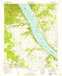
1954 Map of Cherokee
USGS Topo · Published 1958About this map
Cherokee serves as the primary hub in this mid-century survey, situated along the Southern railroad line and the Southern Highway. The landscape is defined by its proximity to the Pickwick Lake - Tennessee River, which serves as the county line between Lauderdale Co and Colbert Co. This era of the valley is marked by a transition from traditional rural settlements like Smithsonia and Georgetown toward recreational and utility developments, evidenced by the Mulberry Creek Cabin Area and the Pickwick Reservation Boundary. Genealogists will find a wealth of burial sites and country churches, including Cherokee Cem, Pride Cem, and the uniquely named Moontown Ch. The historic Natchez Trace cuts through the western terrain, passing near Sellers and leading toward the river, while the broad Kogers Island sits prominently in the main channel.
Find a feature on this map
53 named features on this map. Tap any name to fly to it.
Don’t see what you’re looking for? This feature index may not catch every label — zoom into the map to look around manually.
Map Details
Editions of this 1954 Cherokee Map
4 editions found
Other maps of this area

1911 · Iuka
USGS Topo · 1:48,000

1914 · Iuka
USGS Topo · 1:62,500

1924 · Gravelly Springs
USGS Topo · 1:48,000

1925 · Barton
USGS Topo · 1:62,500

1926 · Barton
USGS Topo · 1:48,000

1926 · Gravelly Springs
USGS Topo · 1:62,500

1929 · Barton
USGS Topo · 1:62,500

1935 · Cherokee
USGS Topo · 1:24,000

1935 · Wright
USGS Topo · 1:24,000

1936 · Margerum
USGS Topo · 1:24,000