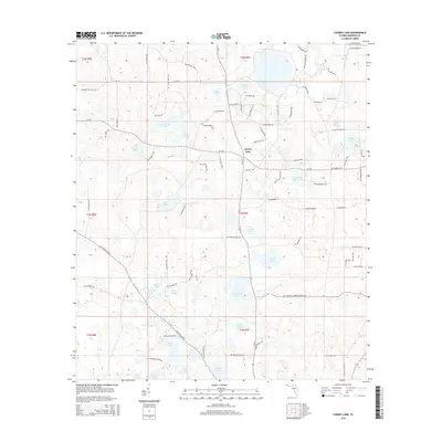
2015 Map of Cherry Lake
USGS Topo · Published 2015About this map
Cherry Lake serves as the focal point for this Madison County landscape, where the settlement shares its name with a large, roughly square water body at its center. The surrounding terrain is defined by an intricate network of sinkholes and depressional ponds, characteristic of the North Florida karst topography. Notable named features include Garden Pond, Elbow Pond, and Rock Island Pond to the north, while the southern reaches feature Bonnet Lake and Armstrong Pond. The map reveals a transition from these clustered wetlands to the more level expanse of Caulk Flats in the east. The human imprint is evident in the grid-like road system, with thoroughfares such as CR-150 and N SR 53 providing regional connectivity across the township and range lines. Local history researchers may find interest in the numerous family-named landmarks like Peeler Pond and Hankins Sink Pond, which suggest a long-standing agricultural and residential presence in the region.
Find a feature on this map
89 named features on this map. Tap any name to fly to it.
Don’t see what you’re looking for? This feature index may not catch every label — zoom into the map to look around manually.
Map Details
Editions of this 2015 Cherry Lake Map
This is the sole edition of this map. No revisions or reprints were ever made.
Other maps of this area

1954 · Greenville NE
USGS Topo · 1:24,000

1954 · Valdosta
USGS Topo · 1:250,000

1956 · Clyattville
USGS Topo · 1:24,000

1956 · Nankin
USGS Topo · 1:24,000

1956 · Baden
USGS Topo · 1:24,000

1958 · Valdosta
USGS Topo · 1:250,000

1958 · Lee
USGS Topo · 1:24,000

1959 · Valdosta
USGS Topo · 1:250,000

1959 · Madison
USGS Topo · 1:24,000

1960 · Cherry Lake
USGS Topo · 1:24,000