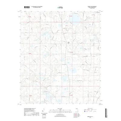
2018 Map of Cherry Lake
USGS Topo · Published 2018About this map
Cherry Lake serves as the central hub for this Madison County landscape, where the town of the same name overlooks a dense network of ponds and wetlands near the Georgia border. The terrain is defined by its unusual hydrography, featuring unique named sites such as Devils Woodyard and Ocean Hole. The presence of Ginhouse Pond hints at the agricultural history of the region, while landmarks like Caulk Flats and Hankins Sink Pond illustrate the karst-influenced topography of the Florida Panhandle. Transportation routes like the Old Valdosta Hwy and NW Settlement Rd cut through a patchwork of cypress ponds and pine woods, connecting isolated family-named ponds such as Dobson Pond, Peeler Pond, and Armstong Pond. This survey provides a modern view of a rural Florida community where life remains closely tied to the water table and small-scale land divisions.
Find a feature on this map
102 named features on this map. Tap any name to fly to it.
Don’t see what you’re looking for? This feature index may not catch every label — zoom into the map to look around manually.
Map Details
Editions of this 2018 Cherry Lake Map
This is the sole edition of this map. No revisions or reprints were ever made.
Other maps of this area

1954 · Greenville NE
USGS Topo · 1:24,000

1954 · Valdosta
USGS Topo · 1:250,000

1956 · Clyattville
USGS Topo · 1:24,000

1956 · Nankin
USGS Topo · 1:24,000

1956 · Baden
USGS Topo · 1:24,000

1958 · Valdosta
USGS Topo · 1:250,000

1958 · Lee
USGS Topo · 1:24,000

1959 · Valdosta
USGS Topo · 1:250,000

1959 · Madison
USGS Topo · 1:24,000

1960 · Cherry Lake
USGS Topo · 1:24,000