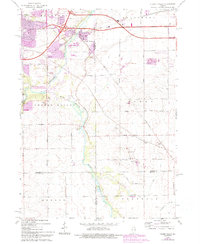
1968 Map of Cherry Valley
USGS Topo · Published 1993About this map
The Kishwaukee River and its South Branch serve as the primary geographical axis for this region at the intersection of Winnebago, Boone, Ogle, and DeKalb counties. The village of Cherry Valley sits at a critical junction where the Northwest Tollway meets established local routes like Cherry Valley Road and Harrison Avenue. This 1960s landscape, updated with 1990s data, illustrates the transition from traditional agricultural patterns to suburban expansion near Rockford and Belvidere.
Find a feature on this map
49 named features on this map. Tap any name to fly to it.
Don’t see what you’re looking for? This feature index may not catch every label — zoom into the map to look around manually.
Map Details
Editions of this 1968 Cherry Valley Map
3 editions found
Other maps of this area

1917 · Kings
USGS Topo · 1:62,500

1918 · Rockford
USGS Topo · 1:62,500

1918 · Belvidere
USGS Topo · 1:62,500

1918 · Kings
USGS Topo · 1:62,500

1918 · Kirkland
USGS Topo · 1:62,500

1938 · Rockford
USGS Topo · 1:62,500

1944 · Belvidere
USGS Topo · 1:62,500

1949 · Camp Grant
USGS Topo · 1:24,000

1949 · Rockford
USGS Topo · 1:24,000

1954 · Rockford
USGS Topo · 1:250,000