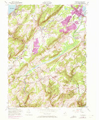
1954 Map of Chester
USGS Topo · Published 1972About this map
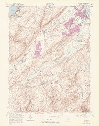
Budd Lake serves as a prominent landmark in the northwest corner of this Morris County landscape, where the waters of the South Branch Raritan River and the Lamington River begin their descent through the highlands. The map captures a transitional era in the mid-20th century, showing established rail lines like the Central Railroad of New Jersey and the Lackawanna Railroad alongside the early expansion of suburban corridors. Settlements such as Succasunna, Flanders, and Chester are documented with significant detail, including local landmarks like Hillside Ch and Bethany Chapel. To the south, the protected woodland of Hacklebarney State Park contrasts with the industrial presence of a Sand Pit and the Valley Airport. The terrain is characterized by the broad German Valley and the surrounding heights of Mount Olive and Pleasant Hill, illustrating the complex topography that shaped early transportation and settlement patterns in northern New Jersey.
Find a feature on this map
56 named features on this map. Tap any name to fly to it.
Don’t see what you’re looking for? This feature index may not catch every label — zoom into the map to look around manually.
Map Details
Editions of this 1954 Chester Map
8 editions found
Other maps of this area

1888 · Hackettstown
USGS Topo · 1:62,500

1888 · Lake Hopatcong
USGS Topo · 1:62,500

1890 · High Bridge
USGS Topo · 1:62,500

1891 · Somerville
USGS Topo · 1:62,500

1893 · Somerville
USGS Topo · 1:62,500

1894 · Hackettstown
USGS Topo · 1:62,500

1894 · Lake Hopatcong
USGS Topo · 1:62,500

1898 · Lake Hopatcong
USGS Topo · 1:62,500

1898 · Hackettstown
USGS Topo · 1:62,500

1898 · High Bridge
USGS Topo · 1:62,500
Featured Places
- Mount Olive, NJ
- Roxbury Township, NJ
- Succasunna, Roxbury Township
- Flanders, Mount Olive
- Budd Lake, Mount Olive