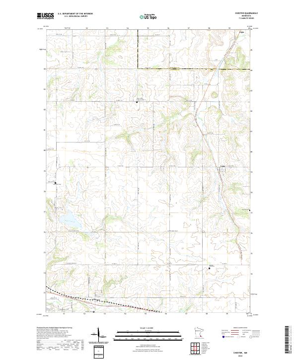
2022 Map of Chester
USGS Topo · Published 2022About this map
Chester sits along the southern edge of this landscape, where the local rail corridor has been repurposed into the Great River Ridge State Trl. This trail follows a diagonal path through the countryside, crossing the N Fork Whitewater River near the small settlement of Viola. The area is defined by a dense network of township roads and county highways, including Co Hwy 14 and Co Hwy 9, which connect dispersed farmsteads across the undulating terrain between Olmsted Co and Wabasha Co.
Find a feature on this map
42 named features on this map. Tap any name to fly to it.
Don’t see what you’re looking for? This feature index may not catch every label — zoom into the map to look around manually.
Map Details
Editions of this 2022 Chester Map
This is the sole edition of this map. No revisions or reprints were ever made.
Other maps of this area

1934 · Plainview
USGS Topo · 1:62,500

1935 · Rochester
USGS Topo · 1:48,000

1938 · Plainview
USGS Topo · 1:62,500

1939 · Rochester
USGS Topo · 1:62,500

1953 · Saint Paul
USGS Topo · 1:250,000

1954 · Chatfield
USGS Topo · 1:62,500

1954 · Mason City
USGS Topo · 1:250,000

1955 · Stewartville
USGS Topo · 1:62,500

1957 · Mason City
USGS Topo · 1:250,000

1958 · Mason City
USGS Topo · 1:250,000