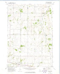
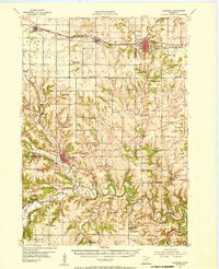
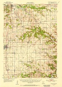
1972 Map of Chester
USGS Topo · Published 1975About this map
Minnesota Memorial Hardwood State Forest blankets the northeastern portion of this quadrangle, defining the hilly landscape where the North Fork Whitewater River begins its descent. In the early 1970s, this region of Olmsted County maintained a distinct rural character, anchored by small clusters like Viola and Chester. The Chicago and North Western railroad provides a clear industrial spine through the southern townships of Marion and Eyota, passing the local Trailer Court and a Pumping Station at the edge of the sheet. Local landmarks such as the Haverhill Sch, the Townhall, and the private Roger Landing Strip offer concrete touchpoints for genealogists and local historians tracing the development of Haverhill and Farmington townships during this era.
Find a feature on this map
25 named features on this map. Tap any name to fly to it.
Don’t see what you’re looking for? This feature index may not catch every label — zoom into the map to look around manually.
Map Details
Editions of this 1972 Chester Map
This is the sole edition of this map. No revisions or reprints were ever made.
Other maps of this area

1934 · Plainview
USGS Topo · 1:62,500

1935 · Rochester
USGS Topo · 1:48,000

1938 · Plainview
USGS Topo · 1:62,500

1939 · Rochester
USGS Topo · 1:62,500

1953 · Saint Paul
USGS Topo · 1:250,000
1954 · Chatfield
USGS Topo · 1:62,500

1954 · Mason City
USGS Topo · 1:250,000
1955 · Stewartville
USGS Topo · 1:62,500

1957 · Mason City
USGS Topo · 1:250,000

1958 · Mason City
USGS Topo · 1:250,000