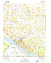
1970 Map of Chester
USGS Topo · Published 1972About this map
The riverfront city of Chester dominates this 1970s survey, situated along the high bluffs overlooking the Mississippi River. The landscape is defined by the complex relationship between the water and the shore, featuring the sprawling State Penitentiary at Menard and the extensive rail operations of the Missouri Pacific. Across the river, the floodplain of Bois Brule and the massive Kaskaskia Island highlight the shifting nature of the state boundary, where the river's historical course has left Missouri land on the eastern side of the current channel.
Find a feature on this map
32 named features on this map. Tap any name to fly to it.
Don’t see what you’re looking for? This feature index may not catch every label — zoom into the map to look around manually.
Map Details
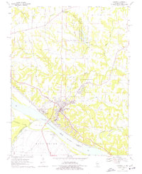
Editions of this 1970 Chester Map
2 editions found
Other maps of this area

1912 · Baldwin
USGS Topo · 1:62,500

1914 · Baldwin
USGS Topo · 1:62,500

1914 · Coulterville
USGS Topo · 1:62,500

1915 · Chester
USGS Topo · 1:62,500

1916 · Campbell Hill
USGS Topo · 1:62,500

1917 · Coulterville
USGS Topo · 1:62,500

1918 · Campbell Hill
USGS Topo · 1:62,500

1942 · Baldwin
USGS Topo · 1:62,500

1947 · Chester
USGS Topo · 1:62,500

1949 · Paducah
USGS Topo · 1:250,000