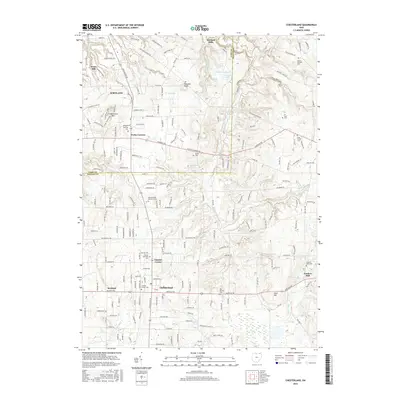
2016 Map of Chesterland
USGS Topo · Published 2016About this map
The East Branch Chagrin River and its various tributaries carve through the glaciated terrain of Geauga and Lake Counties, defining the geography of Chesterland and Kirtland. This 2016 survey illustrates a suburban landscape deeply rooted in its early pioneer history, evidenced by a high density of burial grounds such as Old Settlers Cem and the Brown Cem. The area around Fowlers Mill shows the persistent character of a historic settlement at a river junction, while the rugged topography of Gildersleeve Mtn and Piersons Knob provides a distinct vertical contrast to the residential developments of Waite Hill and Kirtland Hills. Detailed water features, including Corning Lake and Hourglass Pond, highlight the drainage patterns that have historically influenced land use and village placement throughout the Chagrin River valley.
Find a feature on this map
188 named features on this map. Tap any name to fly to it.
Don’t see what you’re looking for? This feature index may not catch every label — zoom into the map to look around manually.
Map Details
Editions of this 2016 Chesterland Map
This is the sole edition of this map. No revisions or reprints were ever made.
Other maps of this area

1904 · Chardon
USGS Topo · 1:62,500

1905 · Garrettsville
USGS Topo · 1:62,500

1905 · Mentor
USGS Topo · 1:62,500

1906 · Chardon
USGS Topo · 1:62,500

1906 · Chagrin Falls
USGS Topo · 1:62,500

1907 · Garrettsville
USGS Topo · 1:62,500

1907 · Mentor
USGS Topo · 1:62,500

1908 · Chagrin Falls
USGS Topo · 1:62,500

1950 · Cleveland
USGS Topo · 1:250,000

1953 · Chardon
USGS Topo · 1:24,000